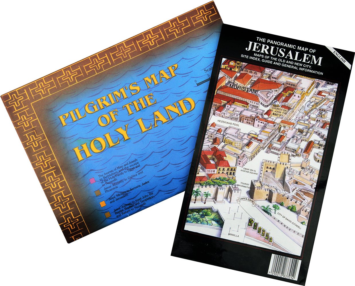


Great Bible study aid for Christians of all ages PILGRIM'S MAP OF THE HOLY LAND.Comes Folded: 24 x 17 cm. (9.5 x 6.75 in.) Opens to: 48 x 67 cm. (19 x 26.5 in.)Beautifully detailed poster map of Jesus Ministry throughout the Holy Land of Israel with landmarks featuring Churches and other ministry centers visited today by pilgrims walking in the physical footsteps of Jesus. Details the Journeys of Jesus.From Nazareth to the Jordan River.Places visited in Galilee: Cana, Nain, Mt. of Beatitudes.On and around the Sea of Galilee: Capernaum, Magdala, Bethsaida, Gennesaret.From Capernaum north to the region of Tyre and Sidon, Caesarea Philippe, into Decapolis.The Transfiguration (Mt. Tabor)Visits to Jerusalem area including Bethany and Jericho.Jesus' last week in Jerusalem - The Mount of Olives His Resurrection and appearance to the 2 disciples on the Road to Emmaus.THE PANORAMIC MAP OF JERUSALEMFolded: 14 x 24.5 cm. (5.5 x 9 in.) Opens to: 68 x 49 cm. (27 x 19 in.)Your complete travel aid for discovering Jerusalem. Included are maps of the Old & New Cities, an index and information about all of Jerusalem's significant sites. One side is an original, detailed drawing of the entire Old City and its surroundings, clearly marking its four quarters and all major roads. The other side includes a detailed Jerusalem city map with drawings and explanations of all major sites.Added Features:Protective cardboard cover. Museum listings and tourist information. Original Old City drawing shows buildings in their actual architectural structure.Printed in the Holy Land.
Trustpilot
4 days ago
1 day ago
