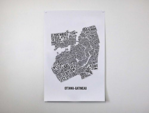
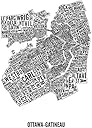
Ottawa-Gatineau Neighbourhoods Map.
Desertcart purchases this item on your behalf and handles shipping, customs, and support to Senegal.
Description
The poster is a geographically exact representation of the different landmarks and neighbourhoods of the National Capital Region. You can identify locations like: Rideau Canal, Byward Market, Lowertown, Hintonburg, Hull, Old Ottawa South, etc. This is the second edition of the map. The design is printed on thick white paper with a matte finish. The Ottawa-Gatineau map is available in 3 formats: - 50 x 65 cm - Screenprinted by hand - 31 x 46 cm - Screenprinted by hand - 22 X 28 cm (printed on card stocks). The poster is shipped in a plastic sleeve which is then put in a cardboard tube to ensure that your item makes it to your place without a dent. If you want, you can come downtown Ottawa and pick up your order in which case I will reimburse you the shipping fees.
Common Questions
Trustpilot