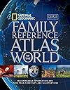
National Geographic Family Reference Atlas of the World, Fourth Edition: Indispensable Information and More Than 1,000 Maps and Illustrations
Product ID: 19009203
Desertcart purchases this item on your behalf and handles shipping, customs, and support to Senegal.
Maps have been around in some form or other since humans first understood the need to record their physical space, and for the past hundred years, the National Geographic Society has been at the forefront of mapmaking. This Fourth Edition of our popular Family Reference Atlas of the World brings you the world and its marvels—through maps. Using the latest technological advances, satellite data has been compiled to create some 1,400 images—maps, diagrams, graphs, and tables, as well as National Geographic’s signature color photographs—to allow you to examine the most remote corners of the globe. In an era when political, health, climatic, and environmental crises anywhere on the globe can affect our daily lives, maps provide a time-honored way to navigate the realities we face. With this atlas, you hold a powerful yet accessible tool to understanding the interplay of global forces at work in the fast-changing but always miraculous planet that is our home. Review: An Excellent Reference - This is a good world atlas for me. It covers the world giving information on location, geography, culture, weather and most any other subject that I am interested in understanding. Even if you are interested in an in depth study, this gives one a good starting point. There are many beautiful photographs illustrating the text and helping the text come alive. I expect to use it as long as I have need of an atlas and then to give it to one of the grandchildren or great-grandchildren. Review: Suited for the Purpose Intended - In planning trips in the US and abroad this atlas is very helpful in gaining a perspective on the proximity of cities and countries. It is also a good refresher as to cities and countries featured in the new and current events. It also has an abundance information that I will probably never refer to unless the weather is bad for a long period of time and I can't go outside.
| Best Sellers Rank | #793,477 in Books ( See Top 100 in Books ) #203 in World Atlases & Maps (Books) #315 in Historical Atlases & Maps (Books) #23,352 in World History (Books) |
| Customer Reviews | 4.7 out of 5 stars 241 Reviews |
C**E
An Excellent Reference
This is a good world atlas for me. It covers the world giving information on location, geography, culture, weather and most any other subject that I am interested in understanding. Even if you are interested in an in depth study, this gives one a good starting point. There are many beautiful photographs illustrating the text and helping the text come alive. I expect to use it as long as I have need of an atlas and then to give it to one of the grandchildren or great-grandchildren.
C**R
Suited for the Purpose Intended
In planning trips in the US and abroad this atlas is very helpful in gaining a perspective on the proximity of cities and countries. It is also a good refresher as to cities and countries featured in the new and current events. It also has an abundance information that I will probably never refer to unless the weather is bad for a long period of time and I can't go outside.
R**R
Good for simple family use
This atlas is what it claims to be--a family atlas for those introducing kids to the world. The maps are smaller and not as detailed as in the more elaborate atlases, and you cannot always find specific towns, but there's lots of good general information to compensate. Nice price, too.
B**8
A good tradeoff
Unless I have missed something else, this atlas (FRAOTW) is the best one that is not named 'National Geographic Atlas of the World, Tenth Edition (NGAOTW). Moreover, a new FRAOTW will cost you about 40% of a new NGAOTW. Sure, this FRAOTW contains less maps than NGAOTW and NGAOTW will have much more detail, map for map. But consider this: 1) I have read that NGAOTW is huge and heavy. Seated in my reading chair, I reach down and to the side to grab the FRAOTW and it is heavy enough to hoist. 2) I'd say 9 times out of 10, the FRAOTW will meet my needs. Did I find in it Kayak Island, where Vitus Bering first saw North America in 1741? No. I'm sure NGAOTW would have had it. But I've found every other place that I was looking for in FRAOTW so far and I do not feel disappointed over not locating an island of only 28.5 square miles! (Besides, that's what the internet is for.) This FRAOTW is supposed to be for casual reference for armchair reading. For that purpose, I am well-satisfied. The word "Family" in the title suggests that it is intended to be suitable for younger readers as well. The FRAOTW is beautiful, I might add. The maps are quite clear and readily understandable. Plus, there is no tiny, unreadable font anywhere, not even in the index. Just don't use it to find geographic flyspecks!
A**R
Beautiful Book!
My whole family LOVES this Atlas! It is beautiful and lots and lots of great maps - very well laid out! National Geographic - what more can we say!
G**G
Very nice
If you need great detail, a cheap paperback local atlas will serve you better. If you want to casually peruse other parts of the world from the comfort of your home, then you can't do better than this atlas. It's impressive. Large, heavy and beautiful. Thick paper stock. Far more than I expected for the price. Another great feature: If the dust jacket becomes tattered you can throw it away. The hardcover is an exact duplicate.
F**E
Great resource
The pictures and graphs and all the maps are a wonderful resource. The index is easy to use. This will serve us for a good, long time.
K**M
We love this Atlas
We love this Atlas! Big bright pages with lots of different kinds of maps for the same regions/states/countries, etc. The text is written for older children and adults but the maps, pictures, and graphics will keep even younger children entertained.
S**R
Four Stars
It"s good
K**D
Great product and price
Great atlas! Love the pictures!
A**R
Three Stars
Still felt like many things missing....very expensive,compared to the informations inside
A**R
No relief for each nation; No transportation and tourism in the theme part
The maps for each nation presented without relief, and the newest information is end with 2014 Also, the theme atlas omitted the communication, transportation and tourism, I think all that are quite important parts, but the atlas omitted Other aspects are acceptable
Trustpilot
1 week ago
2 weeks ago